"One should always have a definite objective, in a walk as in life – it is so much more satisfying to reach a target by personal effort than to wander aimlessly." A. Wainwright A Coast to Coast Walk.
This represents an attempt to hike to the top of 100 peaks in Southern California by the time I retire. I am using the information from the Los Angeles Sierra Club Hundred Peaks Section to identify the good hiking mountains. This all came about as a way to have some sort of target for mountain walking. I find it terribly easy to think about doing things but coming up with excuses not to bother. When I was young, I used to love hiking in the mountains, and I decided I would like to do more of that sort of thing. Whether I am up to it,
30 years on, who knows, but there is only one way to find out. So here we go.
I started planning this during the Spring of 2008, and I made my first attempt with Brynne and Amber in early July of that year, starting up Icehouse Canyon in the eastern San Gabriel Mountains. We didn’t get very far on that hike – it was too pretty to rush, and too hot, but it whetted my appetite, and on July 30 I went back up to make a start on the Hundred Peak Adventure. This narrative tracks my progress.
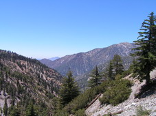
View from Icehouse canyon, July 2, 2008
I decided to camp at Icehouse Saddle for my first serious attempt. From there, I thought I could probably hike Cucamonga, Etiwanda, Bighorn, and Ontario Peaks, and the Three Ts
 (Timber Mountain, Telegraph Peak, and Thunder Mountain). I hoped there would be water at Columbine Springs so I wouldn't have to pack three days of water. In fact, I couldn't pack that much water, so I was pretty much relying on it. My packing for the trip was amateurish, and my pack, wet weight, was 43 lbs. When I was in my 20s, I used to be able to carry a 50 lb pack (had to, since camping food back then was mainly cans of things), so I thought, no problem. I was wrong. Big problem. I set off at 3:40 in the afternoon of Wednesday July 30, 2008, having picked up the required Wilderness Permit form the Forest Service ranger station in Mt Baldy Village. I had hoped that some of the heat would be out of the day by then. The trailhead is about 4900' elevation. It was a tough hike up, it was still quite hot, and the pack seemed to get heavier with altitude. I was happy to see that Columbine Spring was running well, but dismayed to remember just how far back down it is from Icehouse Saddle. By the time I got to the Saddle, at 6:10, I was absolutely knackered. I felt sick to my stomach, and
 I had no appetite. I drank water and snacked on nuts and raisins, and then I set up the tent.
I have a cute little REI Roadster, very light weight, and perfect for Southern California, at least at this time of year. I set it, as it turns out, on a deer superhighway that crosses Icehouse Saddle. Now, I never sleep well the first night out on a camping trip, and I hear everything during the night on the first and every subsequent night. And, of course, if I hear a noise it has to be a bear, Once I don’t hear a noise, it has to be a mountain lion. This particular night, no bears, no mountain lions. Just a whole lot of very noisy deer. As best I could tell, they were galloping down the slope above the tent, trying to leap the log you see just beside the tent, and realizing at the last minute there was something there. They would then dig their hooves in and clatter to a halt. That was what it sounded like anyway. I had visions of deer hooves penetrating the entirely inadequate flysheet and
tent wall, ad of course, me as well. The highlight of the night was when one individual discovered the metal post that holds a trail map, just a few yards from the tent. I assume it is time to practice for the rut, because this individual hit the post, hard, making a huge racket. Then, about 15 or 20 minutes later, just long enough for the adrenaline to subside, he'd do it again. One time I was awakened so dramatically the adrenaline rush actually kicked in the shiver response. I assume that's what happened – the adrenaline was telling me it was time to do something dramatic, so the shivering kicked in to warm up the muscles. That was ridiculous. I could control the shiver by thinking about it, but as soon as I started to drift off to sleep, I'd start shivering violently. I used to like deer, but I don’t much now.
By next morning, I was mentally more tired than the night before, but at least physically I felt a little better. A quick cup of instant  coffee, a granola bar or two, and I was off. As an aside, I had purchased a Jetboil stove for this trip. Very lightweight, and it is truly remarkable – the water was ready for coffee within about 90 seconds. A good purchase. I had decided to attempt Cucamonga and Etiwanda Peaks first, at 8859' and 8662' respectively (Icehouse Saddle is about 7600'). I stashed the tent, sleeping bag, stove etc under some bushes (the Saddle sees a lot of use, and one never knows), and set off at 7:30. It was a beautiful walk, especially the first half hour (typical view shown). Then, there is a saddle followed by a long switchback up. It looks as if the recent earthquake had rearranged some of the scree the trail traverses. Now there's food for thought – an earthquake while traversing a long scree slope. Probably unlikely. Cucamonga Peak itself is reached on a spur off the main Cucamonga Trail, but it is well signed, impossible to miss, even for me. I had previously loaded up the GPS coordinates of all the peaks and trailheads, just in case. Then a brief haul up to the summit, arriving at 9:00. Being as I am doing this for a purpose, I have decided to document each peak. So I take a GPS fix and a self photo. You're going to see a lot of those, I'm afraid. Very narcissistic, but then so is writing this up, so there you are.


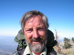
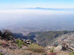
Cucamonga Peak Am I really that old? The view south
Cucamonga was the peak I wanted to do first. I can see it from our apartment in San Pedro (on a clear day), and it has an intriguing shape seen form that distance. It is not as iconic as Mt San Antonio, crudely called Mt Baldy by everyone, nor as high, but I often sat on the balcony and looked at, thinking I would like to climb it. So, an appropriate first peak. And then the second one, Etiwanda. It's a lovely hike from Cucamonga to Etiwanda, not too ridiculously up and down. The spur to the peak is marked by an impressive cairn, off to the left about 20 yards before the trail, which is on the right. Not sure if that is why the cairn is there, but it might be a useful landmark. The spur up to Etiwanda Peak is fairly steep, but short, and the view from the top is worth it.
Etiwanda Peak Apparently, yes The view north to Mt San Antonio
OK, enough self-shots. The rest will remain on my computer. From Etiwanda Peak it was a simple matter of backtracking, and I arrived at Icehouse saddle right at noon. According to my trail map (The Tom Harrison Angeles High Country waterproof one, waterproof presumably against sweat, because there certainly wasn't any likelihood of rain), the DeLorme Topo USA digital
topographic map, and the information on the Sierra Club site, it was a distance of about 8.5 miles round trip, with a gross elevation gain of about 1700 ft. My legs at this point were a bit sore, and my stomach still felt a little out of sorts, but the day was still fairly young, so I decided to try to do Ontario and maybe Bighorn. I checked my water situation, judged it to be adequate and set off. After about a mile I arrived at Kelly campground, which is a primitive campground but has a spring. Now, if setting off on the afternoon hike was my first mistake, not refilling my water here was my second. I climbed up the switchbacks, through a really pretty area of low chaparral scrub and lupines, to the split between the trails to Bighorn and Ontario Peaks, ¾ miles to the former,
1.5 miles to the latter. Ontario first, Bighorn if I have strength. My legs were feeling really tired by now, but the worst of the climbing was over. There are two "false peaks" along the Ontario Peak Trail, and these always have greater significance when one is more tired. I thought I must be close to the peak, so checked the GPS, but I was still about half a mile away. Next peak, still about 0.3 miles away. I was really plodding by now, so, when I finally saw the real peak (at left) , and saw the climb up to it, I figured I'd sit in the shade and rest a while. At this point I checked my water again, and found I had roughly two mouthfuls. Huge problem. Over 1.5 miles from the nearest water at the hottest part of the day, with very little shade on the way back, and already
 exhausted. This was one of the more stupid situations I have put myself in during my life. There was a party of campers at Kelly, but no guarantee they would pass this way. The one consolation was that it was literally all downhill to the camp and the spring. If I could make it back to the trail split, I could more or less slide through the lupines down the mountain to the camp. So after resting for about 10 minutes, I started back. It was not a terribly pleasurable hike, as hikes go, but being downhill did help (that is actually something I did do that was smart, telling myself that I would stop on the way to the peak if I came to a downhill slope, because I knew I'd have difficulty getting back up). After about half a mile, one swig of water, another half mile, by the top of the zigzag down to camp the other half. Shortly after this, I saw the campers hiking up the trail. We exchanged pleasantries (a very nice group of young people), and, restored mentally at least, I scurried down
to the spring. I had left the filter with my tent, but at this point dehydration was more serious a problem than Giardia, and besides, on our scoping trip, Brynne and Amber had both drunk from Columbine Spring without ill effect. So I drank. A lot. And splashed water on my face and neck. And sat for a while. Kelly Camp (left) is beautiful, and very well shaded. So, time to take stock. I did not want another night on the deer highway, and I did not want to wake up in the night with dysentery or in the morning with legs so stiff I couldn't move. Muttering what had rapidly become the mantra of this trip – "It's all downhill" -- I decided to head back down. It was, however, still 4.5 miles. I figured I had to go to Icehouse Saddle anyway, because my tent and everything else were there, then I'd see. I filled my hydration pack - I will not make that mistake again. (However, I am not prepared to accept all the blame. My hydration pack has 1 liter and 2 liter marks on it. When full, it is somewhat over 2 liters. When the water is up to the 1 liter mark, it actually contains about half a liter, or about a pint. 1 liter would have been fine for the afternoon hike, 1 pint was not.) But my new rule of thumb is "Estimate how much water you need and double it. Estimate how much you have and halve it." Back at Icehouse Saddle, I repacked. Another aside – I used my new REI Mars pack for this trip, and I am very impressed. It had room for even more than I took (perish the thought) and it was very comfortable, and at 6 lbs, pretty light. Finding I could lift the pack, and that my legs were so sore I probably would not be able to walk the next day, I set off at about 4:50, at least past the worst of the day's heat. I arrived at the trailhead (and the car) at 6:30 or at a pace of a little over 2 mph. Under the circumstances, I was pleased. Blistered, sore, and queasy but pleased. For the day, I had hiked over 17 miles and gained over 2500' The drive home was unpleasant, because I felt bad and when I stopped for gas, and, later, Gatorade (I got to thinking I was probably suffering a mild case of stoker's cramp, and after the Gatorade I did feel better), I could barely walk. I left the pack in the car when I got back to the apartment – no way would I have made it upstairs otherwise. In fact, it was a while before I could face the stairs, I just sat around most of Friday, pondering on how lucky I had been and how much I hated mountain hiking, and how I would never do it again.