A Hundred Peaks - page 11
Going for higher elevation
But not necessarily making it. On June 24th, 2012, a week after the last hike, I wanted to challenge myself a little more and take on a couple of 9500+ peaks. It seemed like a good plan on paper, and under different circumstances I think I would have made it. As it is, I still hiked three peaks, just not the ones I had planned on doing.
No hiking since the semester began in January, which is typical, but I wanted to get something in during Spring Break. Since mot of the time was spent grading and doing other work-related stuff, in desperation I took off the Saturday, which was March 31, and nipped up to the San Gabriels.
The higher elevations had some snow (and ice), and the Angeles Crest Hwy is closed seasonally about 20 miles along, preventing access to some of the more remote peaks, so I decided on a couple of lower-elevation, close-in peaks that I had not yet done. These had been closed access after the Station Fire in 2009 but were now open - Occidental Peak and Mount Markham, both close to Mt Wilson.
I started out on a rather gloomy morning, with 30% rain probability forecast for the mountains, but I figured, short hikes on use trails or trails, no problem. As I started up the Angeles Crest Hwy I was getting into denser and denser cloud, at one point down to about 100 ft visibility. But coming out onto the crest itself, and it was glorious sunshine. From the turnoff to Mt Wilson there was a wonderful view of the clouds from which I had just emerged. At the Occidental Peak trailhead it wa salmost 70 degrees, clear and sunny.


The start of the trail a nice ridge-walk
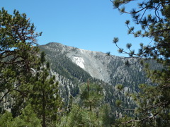
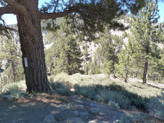
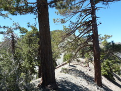
I set out from Guffy Campground, south of Wrightwood, after an easy drive up on a well-surfaced dirt road. It took a while to get there, though, so it was gone 10 before I started.
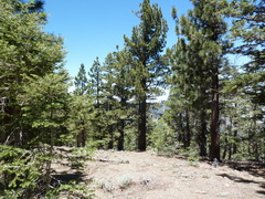
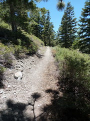
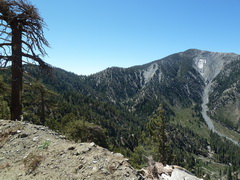
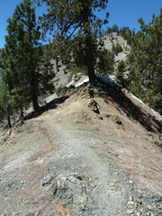
The beginning of the trek is along a dirt road with wonderful views of Pine Mtn. It crosses and re-crosses the PCT, and all-in-all is a nice start to the day. Once at the trailhead, which is well-signed, there was a steep descent and then out onto the ridge. Some up and down, and beautiful walking with spectacular views to both sides.
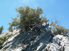
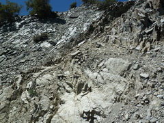
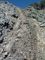
The nice things about ridge-walking are the marvellous views and the fact that you can't lose the trail. The downside, of course, is that you have no alternatives to the trail. So, I had been happy to stroll along the crest or traverse the slopes on a well-marked trail that indicated others had passed that way and the slope hadn't collapsed. I made it over the first knob and was in direct sight of the peak. Then things got ugly.
The trail appears to cross this slope, but it was not entirely clear to me where.
Exploring further didn't seem to help,
and when it looked as if ascending this chute was my best bet, I began to wonder.
The chute lead to infinity and beyond, or something like that - at the top was nothing but a near-vertical drop and a knife-edge on loose rock leading to the left, where I needed to go. I then looked behind me, which was probably a mistake, and saw where I would go if I lost my footing heading back down the chute.
The direction from which I had come was looking better and better, and I chickened out. If I had seen someone else cross that slope, and had therefore seen that the route was safe, I think I'd have been alright. Alternatively, if anyone had known where I was, I might have been alright. As it was, I'm quite happy to admit that I know my limitations.
As a consolation prize, a quick walk up Wright Mountain, a little under half a mile from the trailhead, then a cross-country descent back to the dirt road, and thence Guffy, where I had parked.
Life is hard on the ridge top
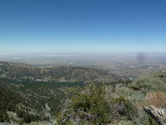
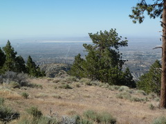
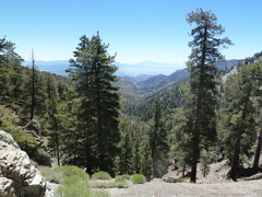
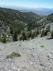
The view to the Antelope Valley
Last look back at Pine Mountain - next time.
I decided to scramble up the slope back to the car instead of walking around on the road.
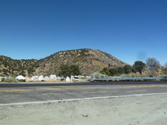
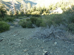
By this time I had only been gone four hours, and only walked six miles, so I decided to hike a couple of other peaks in the area. Next was Circle Mountain, a two-hour round trip from the road of some 2.4 miles. (Yes, I was walking slowly, but in fairness it was quite steep.)
Circle Mountain from the road
A major fire came through here in October 2009.
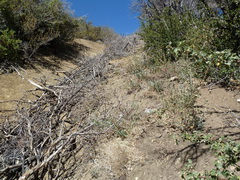
Apparently, a fire break is a good place to pile brush.
The toughest part of the hike is up a fire break, which is faily long and fairly steep. Inexplicably, it has been filled at the upper end with branches cut from burned trees. If it is intended to keep hikers out, it doesn't work, but if it is intended to give a fire some fuel when it reaches a fire break, that would seem to work really well.
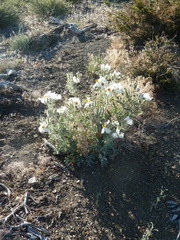
Poodle Dog Bush
(Turricula parryi),
a fire follower
View from the top of Circle Mountain
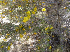
California flannelbush
(Fremontodendron californicum)
Back to the car, and still only 5 pm - time for one more peak. A short drive along the San Andreas fault line, and then a 3-mile or so drive up some slightly less well-behaved dirt roads than those to Guffy, though still no major challenge to my modest 4WD abilities.
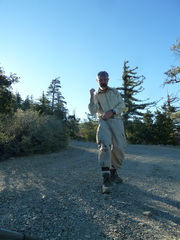
Hiking up Gobblers Knob, towards the afternoon sun.
Chicalote or Prickly Poppy (Argemone munita)
It was a very nice hike, more or less straight up the 32% slope, with not a lot of respite. I don't know why it is called Gobblers Knob - maybe someone was homesick for Punxsutawney, which is apparently the site of the original. The hike back down was rapid, perhaps a little too rapid, because I slipped and got all tangled up with my hiking poles. The result was blackened trousers and a bent pole, both now repaired.
Heading back down, steep, loose rock. Bad combination.
Soot on trousers and sleeve
Modification to hiking pole
When all was said and done, a good day. I got back to the car off Gobblers Knob by quarter past 6 - an eight hour day, but a mere 9+ miles hiked. Some steep scrambles, some spectacular views, and an exploration of a part of the mountains I had not seen before. Interestingly, the latter two peaks, being in the chaparral, were quite reminiscent of the Liebre Mountains, at the western end of the San Gabriels, but also facing north into the Antelope Valley.