
2011 is another year, so I'm hoping to re-start the endeavour. I had hurt my knee last year while running, and there have been a lot of distractions (work, and more pleasurably, a grandson). But enough excuses! Back to the mountains! And that's what I did, which explains why today, Sunday February 6th, I am walking like a little old man, and an unrobust one at that. Yesterday was the re-start hike. Probably should have picked a gentler one.
Mount Wilson. Nominally a 14-mile round trip and 3900 ft elevation gain. Note to self - not 18 any more. Add the close to 2-mile roundtrip from the car to the trailhead, and my lack of mobility today is not really surprising. Got a bit of a late start, and arrived at Chantry Flats at about 9:45. Apparently, the lot filled up by 7:00. It's the base for the easy day-trip up to Sturtevant Falls, and that close to a city of 8 million or whatever, I guess it's not surprising. Anyway, got the Honda snugly tucked into a nook at the side of the road and set off up the road to the trailhead in high spirits. For the first time ever, I hiked with a pair of hiking poles (lightweight, three-section jobbies). I had always considered these the domain of old farts and young poseurs, but I have to take that back. Without those poles I would never have made it to the top of Mt. Wilson. (Though, in retrospect, maybe that wouldn't have been such a bad thing.)
I made good time up the trail - Upper Winter Creek, which seems to cry out for "without a paddle" added on - until I mis-stepped and twisted my foot. Highly embarrassing, as I am used to hiking alone and away from people. My yell of pain (and fear - hiking alone on un-frequenetd mountains makes a sprained ankle a serious issue), which may have included a mild expletive, brought a team of hikers running down the trail ready to fend off mountain lions, wild boars, whatever. If you ever read this - thanks guys, I really appreciated the offers of help, which more than anything else reassured me that I was not in the wilderness, and if I did have a problem it would not be three months in the future that my bleached bones would be found. It would be much sooner. After resting for a minute or two I felt that keeping the joint moving was the best thing to do, so I set off up the trail, knowing that I could turn around at any time and head down. The poles were helping by taking some of the strain off my legs (and ankles) as I went up the steeper bits.


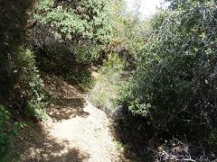
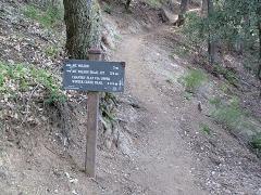
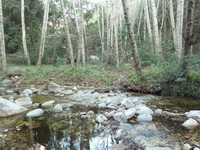
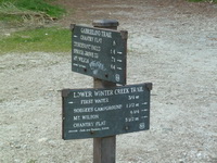
Scenes of the Upper Winter Creek Trail
I made the summit of Mt Wilson at 1:45, having set off from the car (7.8 miles below) at just after 10:00. 3-3/4 hours to get up, plenty of time to get down - sunset is 5:30, but in theory it's quicker heading down. In theory. After a quick lunch on peanut butter and jam sandwiches, I hobbled over to Echo Rock and headed down the Sturtevant Trail. Even though I knew what to expect on the Upper Winter Creek Trail, I thought a loop rather than a there-and-back would be more fun. Fun probably wasn't the word I was looking for. The further I got down the (steep) trail, the more I realised that if there was anything untoward (trail washout, lost sign markers) I'd be up Winter Creek without a paddle, because there was no way I could get back up to Mt Wilson summit. And then, just to make my happiness complete, the trail went into fairly dense woodland, in a canyon, and it was getting quite gloomy at about 3:15. No, sorry, that didn't make my happiness complete, the fact that the trail now started going over and around rocks did. Picking my way along a rock trail in the dark - now that's something I didn't really fancy. Plus, did I mention that by this point my legs were killing me they were so sore and tired? I was decididly glum when I arrived at the first real marker on the way down, the Gabrielino Trail junction, 2.8 miles from Echo Rock (and only about 4 miles from Chantry Flats). My mood was improved considerably by finding that not only was the Sturtevant Camp right there, but there were campers, with fires, tents, all that good stuff. End of concern, and now just 4 more miles of hobbling. The poles were marvellous, enabling me to take the strain off my legs on the steeper downward bits, and, especailly, keep my balance on the stream crossings. Stepping stones and weak legs - not the best combination, but happily, no wet feet. The rest of the trail was very pretty (as it had been all along, truth to tell), but it was a bit hard to fully enjoy it. The last half mile back to Chantry Flats is up a rather steep road, and that was painful. But, I finally arrived there at 5:20, and the last 0.8 miles back to the car, all downhill, and knowing that that was it, were relatively easy - autopilot kicked in.
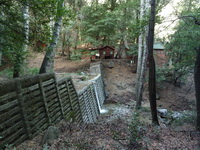
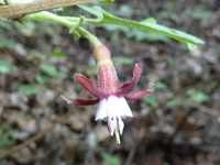
If I ever get to where I can walk again, I'm looking forward to the next peak.
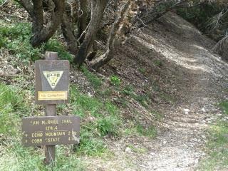
So, the next peak was Mt Lowe, a 13-mile, 3800' day. I took advantage of Spring Break to get one day away from proposal writing and paper grading, and on March 29, a Tuesday (think fewer people on the trails than on a weekend), I headed out towards Pasadena, or some such place, for the Mt. Lowe trailhead. It being a Tuesday, of course, the traffic was horrendous, so a rather late start (9:55). I was right about the fewer people on the trail thing, though. After the first landmark at 2.7 miles I didn't see another soul until I arrived back there on the way down. But I'm getting ahead of myself. The hike starts in a very genteel manner, through the gates of a ruined estate. Lots of dog-walking, senior-ambling, that sort of thing. After a few hundred yards of that, though, it's up the Lower Sam Merrill Trail. This is one of those beautifully designed trails that loses almost no elevation - no wasted effort. It may be the most remarkable I've hiked yet in that respect - it seemed as if I can't have lost more than about 30 feet the whole way up. The lower part of the trail is a reasonable haul up, but it is well switch-backed, and it runs through some of the most beautiful chapparal I've seen. Lots of toyon, chamise, lemonadeberry, black and white sages, sagebrush, and a lot of flowers I didn't recognize. As the sun warmed up (and it was nice mild day) the trail just smelled wonderful. Add to that all the Wrentits singing, and it was a good reminder of why I hike.

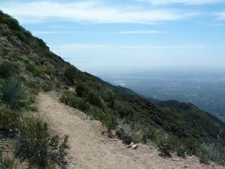
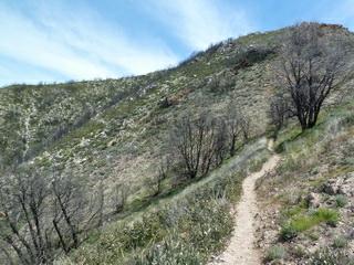
Ceanothus along the trail Looking back down the trail Looking forward - into the burn area
After the ruins of the old Mt Lowe railway (an interesting, if somewhat demented, story), on up the Middle Sam Merrill Trail. From this point on, I was alone - very nice. Up through a burn area, which I assume was part of the 2009 Station Fire, but this part is not closed to the public. It was interesting to see the plant succession - a couple of species I don't know but that certainly seem to be fire followers, and a yucca, which doesn't:
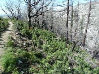
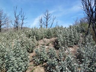
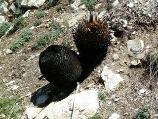
After the burn area, the trail goes into a gorgeous oak woodland, classic San Gabriels canyonside ecosystem. The rains this year must have been good, because the ground was littered with a thick carpet of acorns - the squirrels, jays, and deer just couldn't keep up.
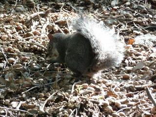
Western gray squirrel, not knowing what to do with all those acorns Top of the Middle Sam Merrill Trail
Then it was back out into the sunshine and up, up, up to the summit. More delightful chapparal, some cool geology, and even some snow!
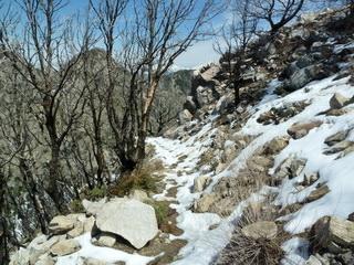
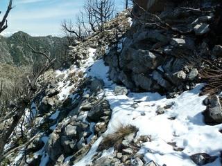
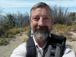
A snowy trail - not quite enough to warrant snowshoes, I think One happy hiker on Mt Lowe summit
I didn't try anything fancy for the hike down. There is an alternate route, but I enjoyed the one coming so much I went back the same way, seeing things I had missed on the way up. The only problem I had on the way down was my left knee, which became really quite sore and resulted in my descent time being longer than the ascent. It doesn't feel too bad today (two days later), though.

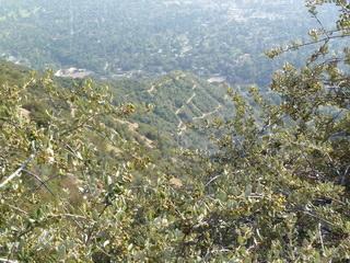
I came from up there? And I'm heading down that?
Not surprising my knee hurt, really.
---------------------------------------------------------------------------------------------------------------------
Well, a few days later and I was ready to hit the trail again. Especially if I could find a relatively short trail. So, it was off to the Pacifico Mountain area on the north side of the San Gabriels on Saturday, April 2, 2011. It's kind of a long drive, up through the San Fernando Valley and towards Palmdale, but finding the trailhead for Mount Emma was very simple. I was on the trail a little before 10, up a well-marked narrow trail. Quite steeply up. There was another couple who started a few minutes before I did, but they were taking it easy, so even though my pace was very modest (about 1.75 mph), I passed them fairly soon. As usual, a day of hiking alone, essentially. And a beautiful day it was, too. On and off overcast and windy to start, getting sunny later but still windy. At the top of Mt Emma, which is about a mile from the trailhead, but 1000' higher up a 20% slope, the trail crosses a dirt bike trail running along the ridge. Easy walking, but crazy steep in places. Those dirt-bike riders have more cojones than I. I was losing my footing, on foot, going down some of the bits. Sure enough, on the peak of Old Mt Emma, I met one of them - a really nice young man, and I have to say I didn't begrudge him his use of the trail. Within a few seconds of his setting off I couldn't hear him, so the solitude was complete again. If there had been hundereds up there things would have been different.
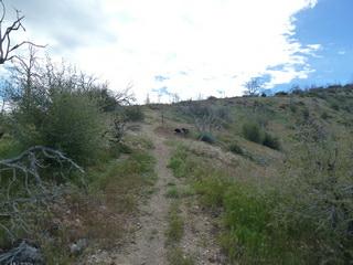
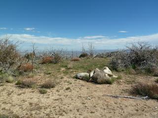
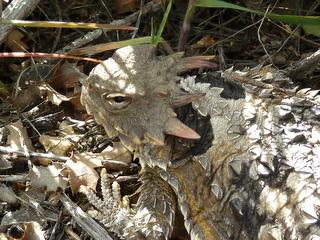
Heading up the Mt Emma Trail The peak of Mt Emma Very obliging Coast Horned Lizard

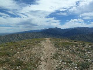
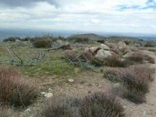
Barely able to stand sideways on the slope Old Mt Emma Along the ridge near Mt Emma
All in all, a beautiful short day's hike. The whole round trip, to Mt Emma, along the ridge to Old Mt Emma, and back, was about 5 miles, and my ankle, my knees, my legs, were working perfectly at the end. Just what I needed after beginning to think I was getting too old for all this stuff. Did I mention it was pretty? Some very nice big views of the Antelope Valley and other peaks in the San Gabriels, some with snow. Pleasant walking, and some good natural history - the horned lizard was great, and I was able to take macro photos of him with my new little camera (which I finally found out how to use for macro, or anything else - put it on super-automatic and don't dick with the settings). It's getting to be wildflower season, and there were a few of those too:
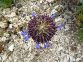
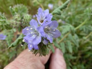
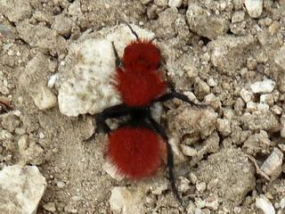
OK, so the last photo isn't a flower, it's a velvet ant. OK, so it's not an ant either, it's just called that. It's a wasp. It's only the females that look like this, and I found out after I got home that a common name for one species is cow-killer, because their sting is said to be so painful it can kill a cow. I'm quite glad I didn't know that when I was getting up close and personal with this one. The wildflower on the left is chia (Salvia columbariae, a sage, not the thing you make pets from), and the middle photo is a Phacelia, I think, but I don't know which species.
Returned to the trailhead by half-past one, giving me time to stop off at the brewing supply house on the way home and get the fixins for a couple of batches of beer. It will taste even better after days like this.