


More areas (and the Angeles Crest Highway) open following the Station Fire, so back to my local mountains (those I can see from the apartment).
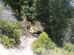
I thought I'd try for a coupoe that were fairly close to the road and not too far along the Crest Highway, so that it wouldn't make for too long a day. So, on July 2nd, following my return from Costa Rica but before heading out on our summer road trip, I headed to Mount Hillyer. Left the parking area in the Chilao recreation area at 09:47 and headed up the Silver Moccasin trail. It's a high-quality trail that goes up a genlt slope through chapparal and fairly soon into a mixed woodland, quite birdy. At 10:30 reached the Horse Flats Campground (accessible by road, but much less fun that way) - a beautiful setting for an equestrian camp, and with no horses around, no flies. Just beyond the campground the trail crosses a pretty little stream, so I spent a few minutes there watching butterflies and frogs. It was a lovely morning, and I had planned a relatively gentle day, so I was able to enjoy.
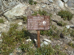
Up the Silver Moccasin Trail Horse Flats Campground White-headed Woodpecker
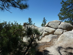
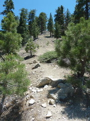
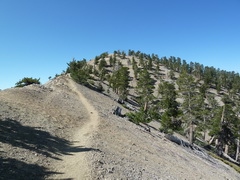
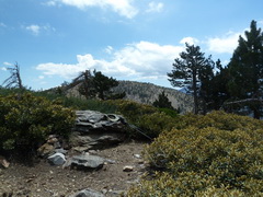
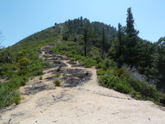
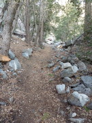
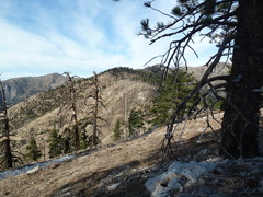
The next part of the trail is the Mt Hillyer Trail, and it is a pretty easy navigate to the top. There is one place where a side trail leads on where the actual trail turns right, and it starts out as wide as the Mt Hillyer, but it quickly degenerates into a chapparal-covered game trail, so not much time lost. Then, at the top there is a false peak off the the left that looks higher, but in fact there's no need to leave the trail at all - right up to the top. There are some really nice grainte outcrops on the trail, and I saw one group of rock-climbers polishing their skills on the one shown here.
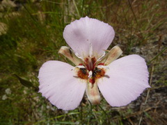


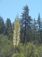
Mariposa lily Lorquin's Admiral Up the Mt Hillyer Trail

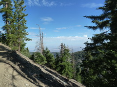
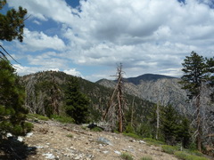
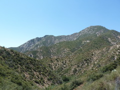
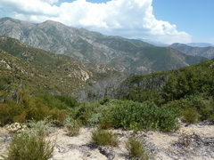
View from the top of Mt Hillyer - hiking conditions don't get much better than this
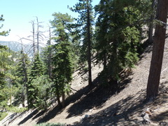
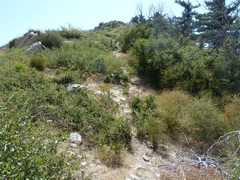
Hillyer is an out-and-back, as are so many of these hikes, but it was very pleasant - hiking through the beautiful formations to get back to Horse Flats, then back down the chapparal, passing groups of kids participating in some sort of character-building-appreciate-nature activity. I was back to the car, after a round-trip of a little under 4 and a half miles, by 12:43. Ah yes, 4+ miles in 3 hours - my kind of pace.
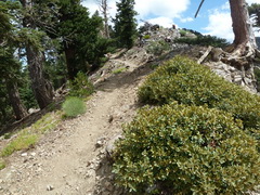
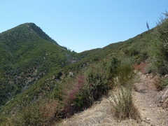
A few miles further along the Angeles Crest is the trailhead for Kratka Ridge (at the 60.54 milemarker, in case anyone is reading this with a view to trying any of these, which is my fervent hope). I set off from the car at 13:26 and slogged up though an old picnic area, which has apparently seen better times, perhaps becasue of all the damn sweat flies. It's pretty, though, on a steep slope with magnificent trees. My infallible sense of following instructions really came into its own here, and within a few minutes I was off the trail and traversing a steep very loose slope. The instructions say to go up along a ridge, but I found what looked like a better path just off the ridge to the north, compared to no trail on the ridge itself, so I assumed that was it. In fairness, others had too, and there were bootprints to follow. In a fairly short time, though, I got back up onto the ridge, on a knob which was just beyond, and considerably higher than, the saddle where I was supposed to head up to Kratka Ridge itself. The view was nice, though.

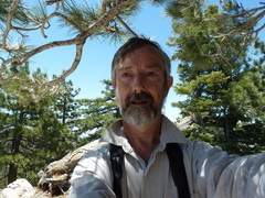
Going up to Kratka Ridge Really cool plant - Pussy Paws Kratka Ridge To show how I've aged
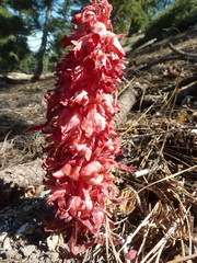
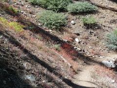
From that saddle there is a use-trail that is amazingly well switchbacked - usually when I see "use trail" I'm thinking hand and foot stuff, but this was a nice one. I think a lot of folks must do this hike. Once at the top of the switchbacks, it's a gentl;e stroll on to and along Kratka Ridge itself to the end. There is an old ski-life terminus up there, that can't still be working, I hope, because the wood is all rotting out. It seems incongruous - a nice strenuous haul up, magnificent views, and this . . . thing. Oh well. Not only are the views amazing, there were plenty of plants up there - groundcone, parasitic on the roots of conifers, was plentiful, and there were a number of dwarfed varieties, or species, up there, in keeping with the challenging conditions. They weren't challenging today, though - nothing short of perfect.
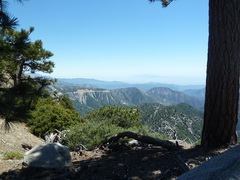
The views from Kratka are truly spectacular, even if the condition of the ski lift isn't. Groundcone.
On the way back the trail form the saddle was about as obvious as a trail can be, and I found my way back along the ridge to the picnic area, wondering how I ever managed to miss it on the way out. Back to the car by 15:08, about 1-3/4 hours to do 1.5 miles. I'm enjoying this laziness.
So, what do I decide to do next, after our big summer trip is over? A 13-mile through-hike with four peaks and 5,200 ft of evelation gain (and 5,100 ft of loss). Happily, most of it is on the Pacific Crest Trail.
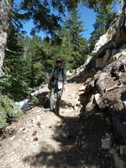
August 13, 2011. Brynne and I drove out Friday afternoon (the day before) and camped at Big Rock Campground, on a Forest Service road just 2 miles from Vincent Gap, the spot on the Angeles Crest Highway where I'm going to start, and where, not coincidentslly, the PCT makes one of its many highway crossings. The campsite was very quiet (at least it was on Friday Night), so well refreshed, we got an early start and were on the trail by 08:00. Brynne had decided to accompany me up Mt Baden-Powell, which is where most of the elevation gain is to be found (3140 ft). All but the last few hundred yards is on the PCT, so it is a very good trail, well switchbacked (long-distance hikers hate scrambling up slopes for some reason). I am happy to take advantage of this.
Up the PCT Through the woods And up to Mt Baden-Powell
It was a delightful day for hiking, once again, and we took it slowly, reaching the peak at 10:30. There were a lot of folks gathering at Vincent Gap, so we were expecting to be part of a long line of hikers, but they seemed to stay in the parking lot all morning. Fine with us. There was just one small party on the top and a few others, so that didn't detract from the experience or the sense of accomplishment.

John and Brynne by the Waldron Tree, a limber pine believed to be about 1500 years old.
Brynne headed back the way we had come, so that she could do some serious nature observing, and I pushed on to the next peak, Mt Burnham. Walking along and just below the ridge was wonderful. The long climb up didn't seem to be affecting me, and I was taking it easy. Passed a couple of troops of Boy Scouts on their pilgrimage to Mt Baden Powell, and all things considered I was feeling pertty good - striding along, miles from anywhere, on the roof of the world. Then I came across the little old Korean ladies. This is something that baffles the heck out of not just me, but other hikers I have spoken to. No matter where you go, no matter how far from a trailhead, no matter how exhausted you are, sooner or later you will meet a group of rather elderly Korean ladies on the trail. I have no idea how they do it - some of them are a good 20 years older than I am and walking along without breaking a sweat. At least I know that if ever I over-set myself, and I find I am exhausted and dying on some mountain slope somewhere, all I have to do is wait for them to come along. Ladies, I salute you.


On the top of Mt Burnham On the PCT between Mt Burnham and Throop Peak On Throop Peak


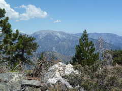
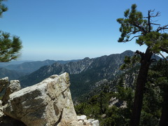
On the PCT between On top of Mt Hawkins Spectacular view from Mt Hawkins
Throop Peak and Mt Hawkins

Throop, Burnham, and Baden-Powell from Hawkins Down the PCT Near Windy Gap
A sight for sore feet -- Brynne meeting me towards the end of the hike.
I felt great all the way to Mt Hawkins, then I realised I had been slouching, and I had planned to meet Brynne at the far end of the hike, Islip Saddle, at 4:00. It was gone 2:00 on the top of Hawkins, and that shouldn't have been a problem - a little under two hours to do the last 4+ miles. Unfortunately it was all downhill, and some of it reasonably steep, so since I felt I had to keep the pace up, I over-did it a bit and my left knee started giving me problems. With 2 miles and 45 minutes left I figured out that at least Brynne is not a worrier, so if I'm not there right at 4:00 that'll be OK. I did crank it up after the Little Jimmy Campground (with 2 miles left) and covered the next mile in 15 minutes - fortunately, it was flat. So I know I can still do that if I need to. And there was Brynne - she had hiked in a mile to meet me, so I was able to slow down and nurse my knee. It does concern me that my hiking pace is so slow, though. I'm getting old. Anyway, down to Islip Saddle at 4:20 and back to the camp for a well-earned beer. Or two. Even though I'm a little disappointed in my hiking pace, and nursing a gammy knee, I'm awfully glad I did it - it was a glorous hike.
Classes begin on August 29, so one last hike before the silliness starts. One day, someone will be able to explain to me why I thought it was a good idea to hike on the hottest day of the year. Until then, I will just have to wonder, and be glad that nothing completely untoward happened. Obviously, I am writing this from the comfort of the apartment, so I didn't die. And I was never in danger of dying, of course, but I was well outside my comfort zone. More of that later.
The day did not start well. I went out at 8:00 am to find some bozo had parked in front of the garage. One of the neighbours saw me standing out there scratching my head and told me to whom it belonged. I went and rang the corresponding doorbell - no response. I walked around the outside of the building loudly announcing that the car blocking my garage would be towed, and I dialed the local police station. Fortunately, someone who knew the owner heard me and was able to wake him while I was still on hold. Apparently, non-emergency calls to the police are not answered. So, sheepishly, he emerged and moved his damn car - it was now 8:30. But, almost no traffic, so I arrived at the trailhead for Pacifico Mountain, on the Pacific Crest Trail, at 10:30. Only then did I find that that specific leg of the PCT was still closed because of the 2009 Station Fire. Very nice that the official Forest Service map of the closure area specifically shows the PCT outside the closure boundary. But, I had a fallback position, as I always do, and that was to hike a short route on the south flank of the mountains. So, a long drive back down to the highway and along to Azusa, where a road leads up alongside the San Gabriel River and to the trailhead for Smith Mountain. This is not one of the more charismatic peaks, topping out at a little over 5100 ft, so I figured out I would be able to find parking, even at that late hour - it was by now gone noon. Sure enough, even though the roadside parking along the river was chock-a-block, I was the only one in the huge lot at the Smith Mountain trailhead. That should have told me something, as should the temperature. But, I wasn't about to let a little heat deter me, so off I went.
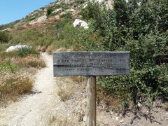
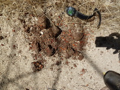
Bear Creek Trail sign Where I'm headed The trail, and beautiful sky Humongous scat - big dog?
The trail is really very nice - it's a gentle upslope, leveling off, and winding around canyon sides, making good use of the contours. It's all in chapparal, and pretty at that, though by late August there was very little in bloom. But at one point there is a spring that was only recently dry (still some drying mud), followed by one still flowing, about 2 miles up the trail. (The trail even has mile markers - it's that civilized.) Although it was hot, it was a nice gentle walk, and I had packed plenty of water. I use the "rule of thirds" I learned when diving - use one third on the way out, one third on the way back, and keep one third in reserve. I had three separate litres of water, so it would be easy to tell if I should turn back before the peak. At one point, close to the 2-mile spring, I heard a cough-like sound off the trail. I feel confident that there was no-one else around, plus it was up a very steep bank off the trail, so I can rule out human. The humongous scat, and a later footprint, indicated a large dog somewhere around, but that didn't make the sound either. I'm left with cougar as the most likely. I don't think either fox or coyote have quite that sound. And I know there are cougars up there, so I think that's what it was. Fortunately, I don't look enough like a deer to cause confusion.

Smith Mtn, looming A garter snake, not well 3 miles up the trail there is a saddle
At 3 miles, the trail reaches a saddle and then heads down and around the mountain. This is where I left the nice, groomed, more or less gentle trail and faced the summit ascent:

This doesn't really do it justice Nor does this This is looking a little more like it
I reached the summit at 1:36, about an hour and 20 minutes after starting, a leisurely 2.2 mph. The next bit was a little slower. There were several places where I had to grab handholds, though mainly I was able to haul myself up with my poles. The distance to the peak from the saddle is about 0.4 miles, and about 900 ft, and it took me an hour. It was hard going, because by now it was brutally hot. I finished the first litre a few hundred feet (distance, not elevation) from the peak, so that was OK. But I was hurting. I didn't stick around, because there was no shade on top, and I quite liked the idea of getting back down to the car. The descent to the saddle was much quicker than the ascent, about 25 minutes, and I figured then it was all gentle downhill from there, so things would be good. By this point I was feeling queasy, though, and the more so if I stopped moving. I really wanted to rest in the shade, but I started getting dizzy if I stopped, so I pressed on. I know from experience that if I do get heat exhaustion, one of the first signs is not wanting to drink, so I monitored that carefully, and I made myself drink on a regular basis. Then, of course, I started worrying about cramps, because I only had water to replace sweat. All in all, it was not the most fun return hike I've ever done. At the spring I soaked my hat, which cooled me a little, and when I got back to Mile 1, I started pouring my reserve litre over my head.


Smith Mountain summit On the way down from the top A very, very happy sight
I made it back to the car, by 4:20, but I was feeling very woozy. I found out later that the high in Azusa had been 106 degrees - I don't carry a thermometer, so I don't know what it was on the trail, but it was too hot, especially as the sun was very intense and there was very little shade. In Azusa I stopped for Gatorade and drank the best part of a quart. I should have some with me if I go hiking in this sort of temperature again. What am I saying? Of course I won't.
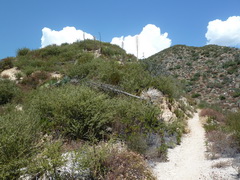
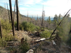
A whole semester got by without my being able to get out in the mountains - I didn't really even have a weekend off. Come the Christmas break, a peak, and before the end of the year at that. So, on Thursday Dec 29th I headed out up the same road that led to death's door last time, but went beyond that parking lot all the way to Crystal Lake. It has been a weird winter so far - an early snow, then nothing, so at the Crystal Lake campground, closed for the winter, there was no snow on the ground. In fact, it was 75 degrees when I set off, ridiculously warm (I now own a little thermometer). It was rather late, around noon, because I didn't want to fight the weekday morning traffic to get here. But I was planning on a short hike, just 7 miles round-trip and a 2,000 ft gain according to the peak guide. The hardest part of the hike was finding the Windy Gap Trail - the road to the trailhead is closed for winter, and at the gate there is a little temporary sign pointing generally up the road. I walked around a few camp loop roads before finding it, but by 12:20 I was on the trail. And a very nice trail it was - oak woodland with a few pines, and some areas that had burned in the Station Fire, resprouting from the roots.


Windy Gap Trailhead A burned area Poodle-dog Bush (a fire-follower) It's a nice trail


Really nice Oaks sprouting from the roots Washout
It's only a short way up the trail (1.1 miles) to the South Hawkins Road, a worn-out dirt road, no longer passable by vehicles, which maintains a very gentle gradient up. There were a couple of washouts, presumably caused by the post-fire floods, but people have formed trails across them, so, again, part of a very easy hike. As well as being of gentle slope, the road is pretty direct, contouring aorund one hill after another, until within sight of a saddle, when it turns back on itself and appears to head for ever in completely the wrong direction. After a bit of that, thinking of going back to the bend and striking out cross-country, though, it starts to behave again and arrives gently at the saddle (4.3 miles). Saddles often mean then having to go straight up the peak, but, once again, this is a civilized hike, and the road continues. There was a little snow by this point.
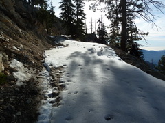


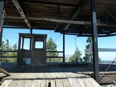
Snow on the road up to the peak At the peak
The snow was thin and fairly crisp, plus I was able to avoid most of it by walking along the edge, which was relatively secure. At the peak, it was clear that the fire had made it that far - no structure left (there used to be a lookout), just some concrete and rebar and charred wood. Oh, and some fused glass. Beautiful views from up there, it was a very clear day, and a balmy 65 degrees. I broke with tradition - no nuts and jerky for lunch but a gourmet sandwich of goat cheese and Branston pickle on rosemary sourdough. Yum. The mileage to the top was 4.8 miles, which makes it hard to see how the whole round trip is 7 miles. Maybe they rolled down the mountain on the way back? I decided against that and retraced my steps - with the walk to the trailhead, it was almost 11 miles. I made the summit by 14:20, or two hours from the trailhead, so I knew I had time for a brief lunch before starting back, but I am surprised by the discrepancy in distance. Even with driving to the trailhead it would have been 9.6 miles round trip. Anyway, a very nice hike up and down.

Walking back down the road
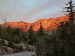
And, when all was said and done, I was treated to a spectacular sunset. New Year's Resolution - get out there and hike more.

![]()
![]()
![]()
![]()
![]()