A Hundred Peaks - page 12
No hiking since the semester began in January, which is typical, but I wanted to get something in during Spring Break. Since mot of the time was spent grading and doing other work-related stuff, in desperation I took off the Saturday, which was March 31, and nipped up to the San Gabriels.
The higher elevations had some snow (and ice), and the Angeles Crest Hwy is closed seasonally about 20 miles along, preventing access to some of the more remote peaks, so I decided on a couple of lower-elevation, close-in peaks that I had not yet done. These had been closed access after the Station Fire in 2009 but were now open - Occidental Peak and Mount Markham, both close to Mt Wilson.
I started out on a rather gloomy morning, with 30% rain probability forecast for the mountains, but I figured, short hikes on use trails or trails, no problem. As I started up the Angeles Crest Hwy I was getting into denser and denser cloud, at one point down to about 100 ft visibility. But coming out onto the crest itself, and it was glorious sunshine. From the turnoff to Mt Wilson there was a wonderful view of the clouds from which I had just emerged. At the Occidental Peak trailhead it wa salmost 70 degrees, clear and sunny.


Yet Another New Year
Yikes. Nothing since August 2013. Work constraints accompanied by a lack of exercise meant I got horribly out of shape. I hadn't realized it had been quite that long when I set off, once again, into the San Gabriels. The week before the hike I had gone up there birding and thoroughly enjoyed it, so on Sunday, June 21, 2015 - Fathers' Day - I headed out to hike Pacifico Mountain, using the Pacific Crest Trail route. The weather was calling for unusually high temepratures, but the two forecasts I looked at had highs in the mountains of 82 degrees and 92 degrees. I split the difference and figured that a high of 87 would be just fine. As it happened, it seemed warmer.
A Hundred Peaks - page 14
Starting off from Mill Creek Summit (the trail to the left, not the road)
Looking back across one of the many, many side canyons along the route.
Being that it was on the Pacific Crest Trail, the walk was stress-free. Not having to think about navigation, and not having to scramble hand-over-hand up a slope, adds to the pleasure of the walking experience, for me. It is a very civilized way to hike, and on the way to the peak, in the morning, the weather was great, with mild temperatures and a light breeze. There were a lot of birds singing, mainly Spotted Towhees, but also Olive-sided Flycatchers and Western Wood-Pewees and even a couple of Black-chinned Sparrows, which are not common around here normally. I wonder if the post-fire regrowth is benefitting them.
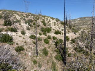
Resprouting scrub oaks in the foreground, the western San Gabriels behind
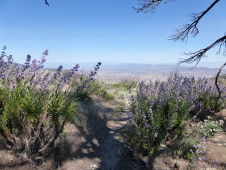
Chaparral Mallow, Poodle-dog Bush (a fire-follower), and resprouting scrub oaks.
Desert Horned Lizard. These animals are very photogenic, mainly because they consider themselves invisible.
More Poodle-dog Bush. Very pretty, and I think it smells good, but apparently some people are deathly allergic to it.
I really enjoy trails that are not gnarly, and the PCT is excellent for that. It was my first serious hike in a long time, so it was good to get the legs working over very gentle inclines. The least manicured part of the whole trail was this gentle traverse.
And then the peak itself. There is a use trail from the PCT up to the top, but it is steep. The kind of steep that on the way down had me sliding. But it was only about a third of a mile and 450 ft of elevation, so shortly over. And the top was very scenic.
Up the side of the mountain
The actual highest point, but I wasn't about to shin up that
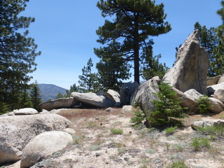
Granite outcrops at the top, good hiding for deer (I saw two)
The way back was a reverse of the route out. All downhill, so marginally faster than the way out, but not a lot. The big problem was that it got hot. There don't seem to be any actual weather stations up in the mountains - well, there are, but I have no idea how to get the data - but I'm guessing it was over 90. That, coupled with my legs saying "wait a minute, we haven't done this in two years," made for a rather pathetic hike back to the car. I had plenty of water, though, and pouring the remains of one of my water bottles over my head when I got back to Mill Creek Saddle felt oh so good. As did drinking the tea-temperature water that was left in the other bottle.
But anyway, a round-trip of about 11.5 miles and an elevation gain of a little over 3,100 ft (2,200 ft net). Now, if I can just keep up the momentum (can one peak constitute "momentum?")