A Hundred Peaks - page 12
No hiking since the semester began in January, which is typical, but I wanted to get something in during Spring Break. Since mot of the time was spent grading and doing other work-related stuff, in desperation I took off the Saturday, which was March 31, and nipped up to the San Gabriels.
The higher elevations had some snow (and ice), and the Angeles Crest Hwy is closed seasonally about 20 miles along, preventing access to some of the more remote peaks, so I decided on a couple of lower-elevation, close-in peaks that I had not yet done. These had been closed access after the Station Fire in 2009 but were now open - Occidental Peak and Mount Markham, both close to Mt Wilson.
I started out on a rather gloomy morning, with 30% rain probability forecast for the mountains, but I figured, short hikes on use trails or trails, no problem. As I started up the Angeles Crest Hwy I was getting into denser and denser cloud, at one point down to about 100 ft visibility. But coming out onto the crest itself, and it was glorious sunshine. From the turnoff to Mt Wilson there was a wonderful view of the clouds from which I had just emerged. At the Occidental Peak trailhead it wa salmost 70 degrees, clear and sunny.
Well, I wasn't able to maintain the momentum. I tried two other peaks in 2015, both in the southern Sierra, and on both days I was defeated by fatigue and weather. The first was an attempt at Five Fingers: I left it too late in the day to start, and when I got to the final ascent over exposed rocks a thunderstorm was closing in, so I scurried back down. The following day I had my second try at Mt. Jenkins. The last time I tried, it was a long hike along the Pacific Crest trail, following another peak earlier that day, and I gave up at the final ascent because I was tired and it required some scrambling. This time, I tried a different, shorter, approach, but it was steep the whole way and I was again exhausted by the time I got to the final ascent. This time, the temperature had reached well over 100 degrees by the time I got there - the rocks I was supposed to scramble over were too hot to touch comfortably, so I gave up - once again in sight of the peak. By the time I got back to the trailhead I was completely exhausted and mildly heatstruck. Bad idea. That experience and a general lack of fitness kept off the peaks until . .
A Hundred Peaks - page 15
Saturday June 30, 2018 Modjeska and Santiago Peaks
I decided to start back into peak-bagging rather gently, so I picked two in Orange County, one that has a 4WD road up to the top and the other that is close by. I didn't do the drive-up, breaking back in that gently would be rather pointless, so I parked at the trailhaed for one of them, Modjeska Peak, and walked from it to the other, Santiago Peak, and back to the truck.
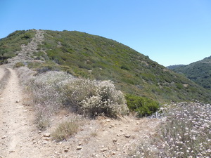
Looking up dirt road to Modjeska Peak. Spur trail to right goes to Santiago Peak.
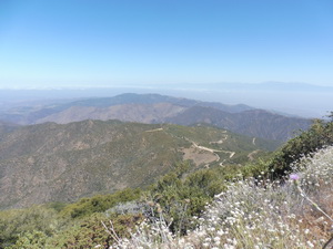
The walk up the dirt road to Modjeska was on a gentle slope and had a good level surface, just what I needed. Spectacular views from the top, including a nice preview of the trail over to Santiago. No navigational challenges on this one, and a modest distance and elevation gain. It was a good choice for my first day back.
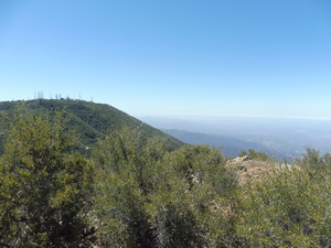
Santiago Peak from Modjeska Peak.
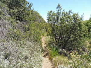
Beautiful trail from Modjeska across the slope to Santiago.
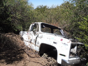
No idea how this got here. There is no road upslope of it.
Looking back down Santiago trail
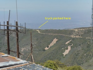
Scenic Santiago Peak looking back to the trailhead.
The whole hike was 5.7 miles, with a total elevation gain of 1865', and it took me 3.5 hours. The temperature was mild. All in all, a very nice day out.
